



A Short History of Gale Lane: From Farm Track to Residential Street
How the lane evolved from a working farm track into a residential street — and the maps, photographs and records that let you trace that change yourself.
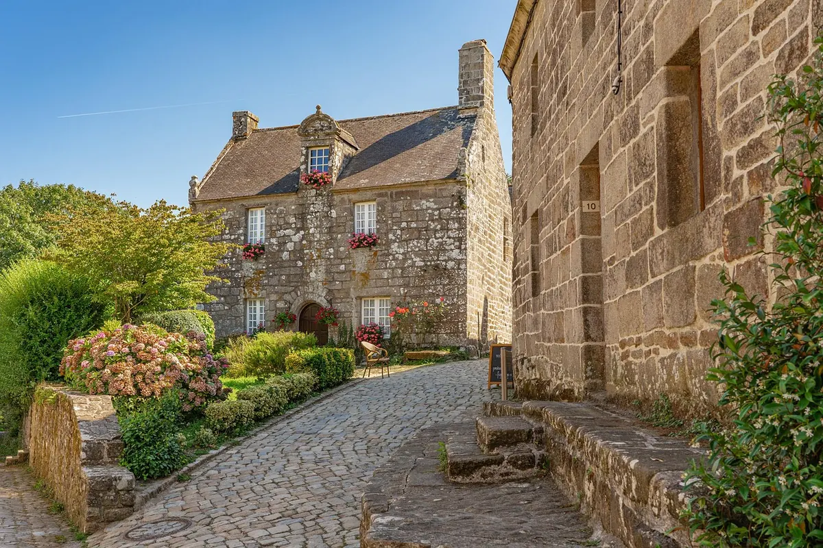
The lane bends twice between the main road and the field gate at its far end, and neither bend makes much sense if you only know it as a street of houses. That double curve is the first clue. Roads built for traffic run straight; routes that grew out of farm tracks follow the hedge line, the ditch and the lie of the land. Most of Gale Lane's history is still legible, if you know where to look.
A track with a job to do
For most of its life the lane was a working route rather than an address. It joined a farmstead to its fields, and it carried whatever the season demanded: cattle and milk churns, feed and hay, manure out and crops in.
The shape of it tells you how it was used. A lane that narrows between hedges and then widens at a gateway was built for carts that had to turn. Passing places, splayed entrances and the odd triangle of grass at a junction are the same story told in different ways. On the ground, the clues are still there — hawthorn and ash in the hedgerow, a ditch on the uphill side, mature trees standing at odd angles to the houses built around them.
On paper, the track appears on tithe maps and enclosure awards long before it appears on any street plan. By the 1880s the Ordnance Survey was drawing lanes like this one at 1:2500 as a thin double line with hedgerow symbols, a couple of buildings at most, and field boundaries running off at right angles. That sheet is the single most useful starting point for anyone tracing the lane's earlier life.
The first houses
Change usually arrives at the ends of a lane before the middle. A cottage or two near the main road, a smithy or a smallholding, a house put up by someone who worked nearby and wanted a plot with room for hens — that is the typical first phase. Then the pace picks up.
Between the wars, councils and speculative builders put up houses along lanes such as this one all over the country. Look for the signatures: semis in mirrored pairs, bay windows, pebbledash or render over brick, hipped roofs, front gardens deep enough for a hedge, and back gardens long enough for a vegetable plot and a shed. Houses on the main road are often set further back than later development, because those plots were sold before there was much to build beside them.
The lane also acquires a name and a postal address at roughly this point, which is worth noticing. Naming is a sign that a route has stopped being a track between fields and started being somewhere people live.
Kerbs, drains and the end of the ditch
Infrastructure tends to arrive in a predictable order, and old photographs often catch it mid-change. The surface comes first: gravel, then tar spray and chippings, then tarmac. Drainage follows, and a ditch that once ran along the front of the plots is culverted, covered and turned into a grass verge or replaced by a low wall. Lighting comes next, then pavements — and sometimes the felling of the trees the pavement had to be laid around.
Street furniture is a rough dating tool. Concrete lamp columns, cast iron gullies and small square utility covers belong to different decades, and the mix along a road like this one usually shows at least three phases of work. When you find an old photograph, look past the people and the cars to the kerb line, the road surface and the poles. They will often give you a decade even when nothing else in the picture can.
What to look at, and where to find it
Almost everything you need is free to consult, either online or in a reference library. The trick is to work from the broad picture down to the detail.
- Tithe maps and apportionments (mostly around 1840 in England and Wales) — plot by plot, with owners and occupiers named
- Enclosure awards and plans, usually held at the county record office
- Ordnance Survey 1:2500 county series, revised every few decades from the 1880s onwards — the best way to compare then with later
- Post-war OS sheets and aerial photographs, held by county archives and national aerial survey collections
- Trade directories, which list residents street by street and fill the gaps between censuses
- Census returns, for occupations and household size
- Local newspaper archives, good for planning rows, road improvements and street parties
- Council minutes and building control records, which often record the year a road was adopted
- Old postcards and family albums, the source of most of the detail the official record leaves out
What vanished, and what quietly stayed
Farms, orchards and ponds go first. What survives is subtler, and usually more useful. Field boundaries reappear as garden walls running at an odd angle to the houses. A mature oak or horse chestnut in a front garden was almost certainly there before the house was. The line of the lane itself is the strongest survivor of all: if it bends, it was bending for a reason long before anyone laid a drive.
Names keep records too. Cul-de-sacs called Orchard Close, Meadow Way or The Paddock are often built on exactly what they are named after, and a lane that shares its name with a farm is usually the road that once served it. Local history societies and the reference collection at your nearest large library will have photographs — and often the memories that go with them.
Tracing your own stretch of the lane
- Start with the largest-scale map you can find, then work down. A modern 1:1250 sheet shows plot boundaries, and boundaries are the most stubborn features of all.
- Put two editions side by side — say a 1:2500 sheet from the 1890s and its next revision — and list everything that changed between them.
- Check the tithe map and apportionment for field names. They frequently explain a street name a century later.
- Run through trade directories for several consecutive years and note when the first non-farming occupations appear at the lane's addresses.
- Ask the people who were there. A neighbour who arrived in the 1960s can tell you where the ditch ran, which tree came down in the storm and which house was always the odd one out.
- Photograph the surviving details now — verges, walls, railings, trees, utility covers — and label the back. The next person to ask these questions will be grateful.
One caution: for anything involving boundaries, rights of way or who owns what, speak to the county council's highways team or take proper legal advice. Local history is a fine guide to how the lane came to look the way it does, but it is not a substitute for the record.
Photo: ChiemSeherin / Pixabay